Real-Time Satellite Data for Environmental Intelligence and Decision Support
Overview
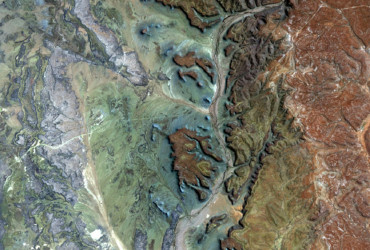
EORIC’s Earth Observation (EO) Laboratory provides high-quality, near-real-time satellite data and advanced geospatial analytics to support research, development planning, environmental monitoring, and emergency response. Our services are tailored for governments, researchers, industry actors, and development partners who require timely, spatially accurate, and science-based insights. Our facility integrates satellite ground stations, DVB-based data reception systems, and automated data pipelines to acquire, process, and deliver Earth Observation products at local and regional scales.
Satellites Tracked by EORIC
The EO Lab receives data from a constellation of polar-orbiting and geostationary satellites, including:
– NASA TERRA
– NASA AQUA
– Suomi NPP
– NOAA 18 & NOAA 19
– METOP-A & METOP-B
– FENGYUN 3B
– GEONETCast Broadcast Data
These satellites provide various environmental observations, including land surface temperature, vegetation indices, atmospheric parameters, wildfire detection, rainfall estimates, and ocean colour.
EO Data Products and Applications
EORIC’s EO services include:
– Weather and Climate Monitoring Products
– Vegetation Indices (e.g., NDVI, EVI)
– Wildfire Detection and Burn Area Mapping
– Rainfall Estimation and Drought Monitoring
– Land Surface Temperature Mapping
– Air Quality and Aerosol Observations
– Land Use / Land Cover (LULC) Mapping
These products support agriculture, forestry, health, disaster risk management, energy planning, and biodiversity conservation applications.
Data Access & Catalogue
EORIC maintains a growing data catalogue of EO products accessible to researchers, institutions, and national agencies. [Download Data Catalogue]
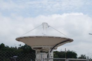
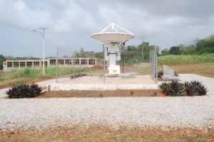
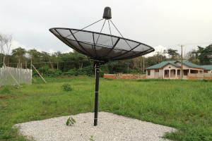
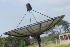
Infrastructure and Capabilities
Our EO infrastructure includes:
– Ground station antenna for real-time satellite tracking
– High-performance computing and storage for big EO datasets
– GEONETCast Receiving Station
– Remote Sensing & GIS Lab for image processing and analysis
– Data servers and web-based access systems
Capacity Building and Training
EORIC also offers short courses and practical training in:
– Satellite data interpretation
– GIS and remote sensing techniques
– EO product development and visualisation
– Applications of EO for natural resource management and climate studies
Who Benefits from Our EO Products?
– Government Ministries & Agencies (e.g., MoFA, EPA, NADMO, Forestry Commission)
– Academic and Research Institutions
– Development Partners & NGOs
– Farmers’ Cooperatives & Environmental Planners
– Disaster Risk Management Units
Get In Touch
To access EO data, partner with us, or request a customised product, please contact:
Email: eoric@uenr.edu.gh
Location: UENR Campus, Sunyani, Bono Region, Ghana