Geospatial Intelligence for Research, Decision-Making, and Development
Overview
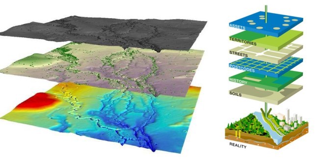
EORIC’s GIS Analysis & Data Services unit provides comprehensive geospatial support for research, planning, and project implementation. We specialise in designing, developing, and maintaining geographic information systems (GIS), custom maps, and spatial datasets to support academic, governmental, and industry applications across Ghana and Africa. Whether you’re mapping environmental trends, analysing spatial patterns, or building interactive web-based geospatial tools, our team delivers the expertise and data solutions you need.
Our Core Services
1. Data Needs Assessment
We help clients define their geospatial requirements and guide them in identifying the most appropriate datasets and analysis methods.
2. Geospatial Data Requests
Access curated geospatial datasets for use in research, planning, and monitoring activities. We provide both raw and processed spatial data based on your needs.
3. Spatial Analysis & Modelling
We conduct a wide range of spatial analyses, including:
– Land use/land cover change detection
– Hotspot and proximity analysis
– Network analysis (transport, utilities)
– Suitability modelling for agriculture, urban development, and conservation
4. Geocoding Services
Convert address and location information into mappable geographic coordinates to support business intelligence, health surveillance, and asset management.
5. Cartography & Map Design
We produce professional, high-quality maps tailored to specific research, policy, or field operation needs. This includes thematic, topographic, and interactive web maps.
6. Custom Map Development
Design custom GIS maps for presentations, reports, and dashboards—leveraging local, national, or regional datasets.
7. GIS Support & Advisory Services
Need technical help? Our experts provide on-demand GIS support, including:
– Troubleshooting
– Software recommendations (e.g., QGIS, ArcGIS)
– Workflow optimisation
– Guidance on best practices in spatial data handling
Tools & Platforms We Use
– ArcGIS Suite (ArcMap, ArcGIS Pro, ArcGIS Online)
– QGIS (Open-source GIS platform)
– PostGIS / PostgreSQL for spatial databases
– Google Earth Engine for cloud-based geospatial analysis
– Python / R for spatial data automation and modelling
– Web GIS using Leaflet, GeoServer, and Mapbox
Who We Serve:
– Research institutions and universities
– Government agencies and local authorities
– Urban and regional planners
– Environmental and conservation NGOs
– Health and epidemiology teams
– Private sector enterprises
Capacity Building & Training
EORIC also offers custom training workshops and short courses in GIS and spatial analysis:
– Introduction to GIS and Remote Sensing
– Advanced GIS Techniques (3D mapping, spatial modelling)
– Thematic cartography and dashboard development
– Data visualisation for decision-makers
Let’s Collaborate
Do you need help with mapping or spatial analysis? Are you looking for a reliable GIS partner for your project or research?
Email: eoric@uenr.edu.gh
Location: UENR Campus, Sunyani, Ghana
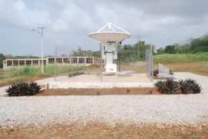
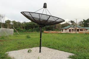
Infrastructure